
Lechtal Alps: Around Namlos Wetterspitze hike - Sept 21
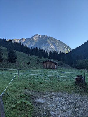
We started from Namlos village, there are free parking spots along the road.
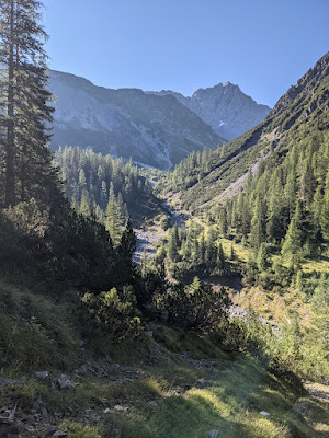
The initial road leads to the Fallerschein dorf. We continued ascending along the river. The trail follows the river, so we had to cross it just once. It was not that wide so it was easy to jump over.
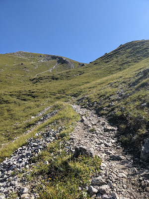
The trail goes to the saddle below Namlos Wetterspitze. This is when the real climb starts - 500 meters to ascend. Namlos Wetterspitze is 2553m high. I thought it would take too long to reach the summit. There is a cross at the top and also the summit book.
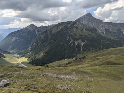
We descended towards the Anhalter hohenweg. From the distance the trail looks challenging but it is actually wide enough. No scrambling. This is one of the nicest spots of the day. It is worth looking back from time to time. Once the ridge ended, we had to descend down to the trail going to the hut.
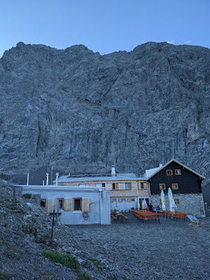
It took us 40 minutes or so to reach the hut. It was renovated recently (opened for sleep-overs 2 weeks ago only). The rooms are completely new. The location is very good, the views towards many peaks is something to remember.
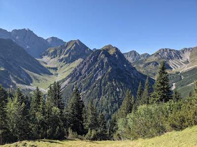
The second day was another sunny day. We saw plenty of people going to Namlos Wetterspitze peak but our destination was in a different direction. We first ended up at a quite short ridge (Faselfeiljöchel) where we turned right down to the valley. We follow Faselfeilbach river. There was a bridge where we wanted to cross but it was wiped away. We just jumped via stones. Once we got to the other side, we started ascending through the forest. The trail is split into several smaller ones created by cows or water. There is a nice creek with steps along the way. We were surprised to see it here as this trail is not marked. Once we left the forest, we saw a cabin. Perfect spot! There was no one or cows. The trail continues above the hut to Rudigerkopf. It is quite wide as it seems someone maintains it for cows. We reached the top of Rudigerkopf within a half hour. The best part of the day starts. The ridge is wide, nothing scary. We were following the trail and enjoying the scenery. The ridge ends at the Schlierejoch saddle. We had to join another ridge, leading to Engelspitze. The last summit of the day and what waits ahead is just Namlos village. The descent was boring (compared to what we hiked during this weekend) and slippery.


Tour info
- Drive
- 2:00 hours
- Start
- Parking lot right after Hängebrücke Namlos. There are 3 small parking lots along the road, free
- Duration
- 12 hours (total)


