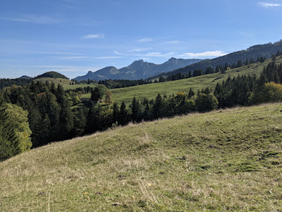
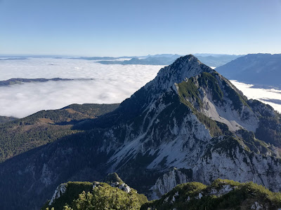
Jekyll2023-03-15T17:57:41+01:00https://alpineduo.com/feed.xmlAlpine Duo blogWelcome to Alpine Duo, personal couples blog where we want to share our outdoor adventures with some personal input but also GPX files, pictures, or amateur guiding advice*. Most of the content is related to skiing/ski-touring, MTBing, hiking or climbing.Alpine Duocontact[at]alpineduo.comLenggries: Seekarkreuz and Schönberg skitour - Jan 222022-01-28T00:00:00+01:002022-01-28T00:00:00+01:00https://alpineduo.com/skitour/2022/01/28/seekarkreuz-skitourSorry for not posting more than 2 years any skitour adventure. I realized the last one is from 2019, pretty sad, isn’t it? We did plenty skitours, we just haven’t got time to write or they were not interesting.
I was looking for a skitour with multiple possibilities for ski descent. We went up to Seekarkreuz 2 years ago as hikers after my shoulder dislocation. I still remember skitourer who went down a south facing slope. I was so envy I could not be him at that time. As there are multiple peaks around like Schönberg or Hochplatte, we decided to give it a go.
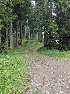
We started from the private parking (as I recall it’s cheaper than the regular one - at least for now…). When I was planning the skitour, I did not notice one important detail. Going up to Seekarkreuz from Hohenburg is 10km on the access road. It is quite flat, so not ideal for skinning up - to clarify - it is boring).
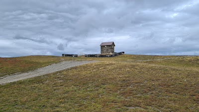
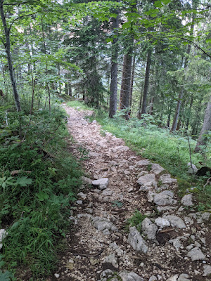
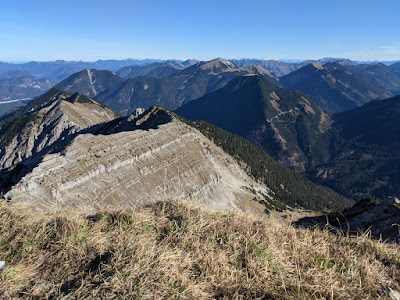
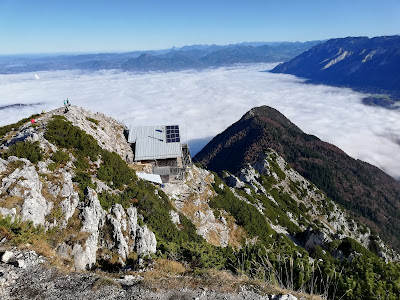
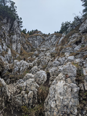
Once we got out of the forest (close to Brandkopf), we saw Seekarkreuz. The way up from the east is easy, just stay away from the right side as there are blown snow patches. The descent was quite good. Sometimes snow crust, sometimes powder. We stopped at Rauhalmhütte, where we took a short break.
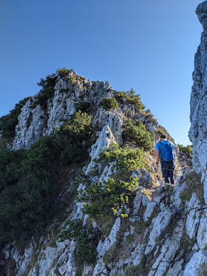
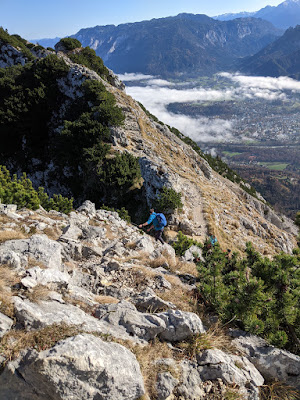
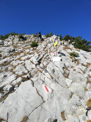
We continued from Rauhalmhütte towards Schönberg. The path is marked here due to nature reserves all around. We continued via the top hiking route (we realized there is skitouring way around as there was a fence and a lot of trees blocking the way). The ascent to Schonberg from Mariaeck is easy. There are only very few steeper parts (where the trail gets narrow).
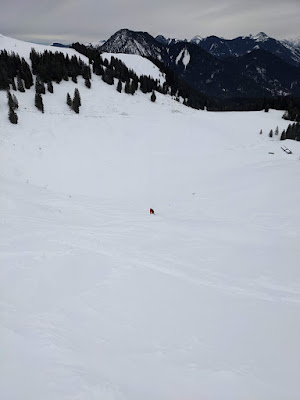
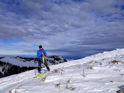
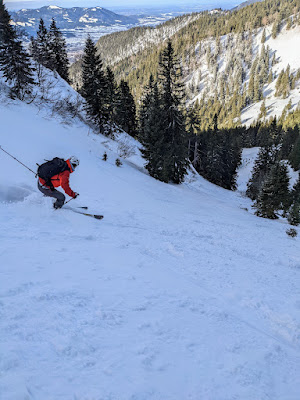
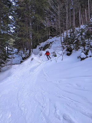
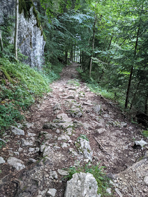
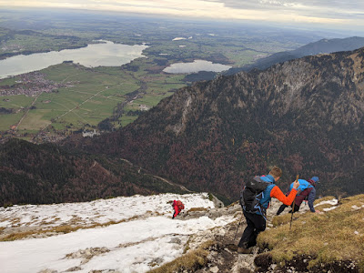
It was windy at the top and we hesitated for a moment to continue to the cross and go down from there or just the way we went up. We decided to go down via the west descent route. This was the best part of the day as I can tell. We were deep in the powder snow, steep enough to do nice turns. After all the nice turns, we did couple of more turns through the forest and we joined the access road. There was not much snow further down, the access road contained a lot of stones. We had to carry our skis often.
Seekarkreuz and Schönberg skitour - Jan 22
Tour info
Drive
1 hour
Start
Parking lot at Hohenburg, the other one after the river - private one, 2 euros
Ascent
around 6:30 hours (Note, we were slow and waiting for other group)
Activity view
]]>Alpine Duocontact[at]alpineduo.comChiemgau: Schwarzenberg trails mtb - Oct 212021-10-03T00:00:00+02:002021-10-03T00:00:00+02:00https://alpineduo.com/mtb/2021/10/03/schwarzenberg-trails-mtb-21The sunny and warm days came back! The first October weekend was very good weather, perfect for bike ride.
We started in Festhalle Aschau parking lot, it’s paid since few years. There was a control check at lunch time. The first kilometers are going around Rohnerkopf. This traverse is on the gravel road, it is going through multiple different meadows. We passed by the parking lot at Lederstube, the usual spot for Hochries hikes.
The ascent starts at Kranzl tiny village. There is one descent between and we were right below Schwarzenberg. The trail goes down to Winterstubn. There are two options, the last time we chose trail on the right. There are wires along the trail, we did not feel confident passing by. This time, we went to left. The trail is easier. After about a kilometer, we joined the gravel road. It continues all the way to Hofalm. This is the most crowded part, where we met lot of hikers.
From Hofalm, we descended through the meadow towards the forest. This is Auenland trail. The part in the forest contains lot of rock sections, I would rate it as S2 (S1 often but there are few parts S2). We returned back to Hofalm and we continued down to Aschau.
The third trail of the day is Milliweg trail, rated as S2 (first half is S1, later lot of loose rocks, few S2 spots). There is a respect sign at the beginning, it was not here back then. We always respect hikers and let them pass first, it’s not about pushing your bike.
Schwarzenberg trails mtb - Oct 21
Tour info
Drive
50 minutes from Munich
Start
Festhalle Aschau parking lot, 5 euros per day
Duration
2:30 hours
Activity view
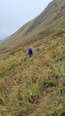
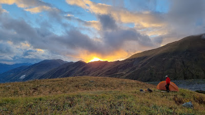
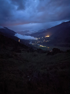
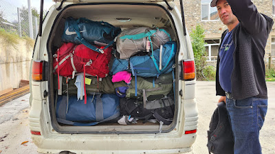
]]>Alpine Duocontact[at]alpineduo.comGeorgia: Mestia - Usghuli 8 days hike - Sept 212021-09-13T00:00:00+02:002021-09-13T00:00:00+02:00https://alpineduo.com/hike/2021/09/13/mestia-hiking-getaway-21We visited Georgia in September the previous year. The plan was to be 2 weeks in the mountains crossing various mountain ranges. Similar group of people I was with in Tajikistan. This time, we were a bigger group as each one of us took on one more person. There were a total of 8 people.
There is a good flight connection from Prague or Memmingen, so we decided to fly from Prague as most of the people were coming from Slovakia. Initially, we were worried about covid situation but it turned out to be just worries. We were required to be tested to board the plane, same for entering Georgia. We had no problems getting to Georgia or on our way back.
Day 1 - Hikes around Mestia
The initial hike was from the Chubedishi viewpoint. Our friends continued, but not us. Why? As we landed in Kutaisi, Danka found out her shoe soles were broken. They were looking good when we were waxing shoes a few days back. Our day guest was to find new shoes in Mestia. We thought there would be at least one shop having outdoor gear. We couldn’t find one. We found a few stores with second hand shoes, one had leather hiking boots in dankas size. They also had north face clones but without any membrane, maybe good for city walk only? We decided to buy the leather ones. As it was only early afternoon, we went for a second hike to try new old shoes. All went well, we traversed forest north from Mestia and returned via the city back to our accommodation.
Day 1: Mestia short hikes - Sep 21
Day 2 - Zuruldi massif hike (from Mestia to Zageni village)
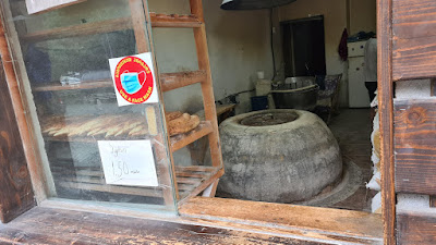
First, we bought fresh bread and withdrew money as we were leaving civilization for some time. We continued to the ski lift. Only the first part of the lift is in use. They are building the new upper part as we saw construction going on.
It took us only one hour to reach the top. The bar was closed, I guess they are open only during the winter season. We continued hiking through the ridge. The trail goes through the forest most of the way. We did a short break at the Metashi, the peak has 3 tall transceivers. Now the tricky part. The steep descent, slightly technical. It’s better to be on the right path. There are meadows with cows where we enjoyed the sun and started going down to Tsvirmi.
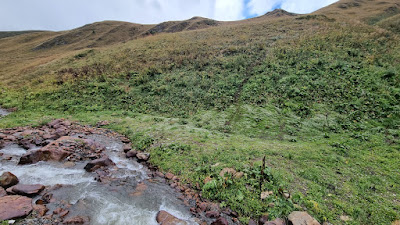
We had to go lower down to Bogreshi. The trail is tricky to find first as the maps show paths that have fences installed. We crossed one and just passed through the meadow to a stream and then further traversed down to the village.
There are two markets at Bogreshi, but only one was opened. It is run by a local lady who has few things at home like bread, beer, coke, honey.
The last ascent led us to Zageni. A lady was greeting us and she offered us her home. We agreed to spend a night there. It was quite a unique experience, the house is built from rocks, and there is a local oven in the main room where we had dinner with them. Her husband was very talkative (only Russian language). They offered us their local spirit as well. The food was great, no meat, only cheese, bread and a variety of processed Vegetables and fresh salad. They baked fresh bread for breakfast, made fresh cheese. We asked for a snack to go, of course they packed us with a few things.
Day2: From Mestia to Zageni hike - Sep 21
Day 3 - From Zageni to Lasil pass
The trail starts as a road, probably the first 5 km. There are 3 newly built. After the last bridge, the trail becomes more narrow.
We had to cross the river here as the path is on another side. As the river splits it is easier to find a few stones to jump on. We stayed on the left side until the pass. There is a trail on the right side but looks tricky due to erosion.
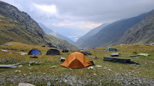
As it was getting dark soon, we started looking for a campsite. There is one good spot on the right side but it’s at 2000 masl. We were convinced there is a better spot higher. We found one at 2700masl, directly below the Lasil saddle.
There is a river closeby, and a few good spots for tents. We found old canisters left here so people camped here. Also cows go up here.
It started heavily during the night. Two storms passed by. The day was the same. We experienced around 5 storms. Two were quite close to us.
Day 3: From Zageni to Lasil pass - Sep 21
Day 4-5 - Stuck below Lasil pass for 2 days
We were still trapped below the Lasil saddle. It rains and rains the entire day. We managed to have breakfast at 10am, when it stopped raining for a couple of minutes. Same for dinner. We got a weather forecast, and it should improve tomorrow.
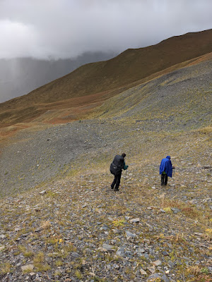
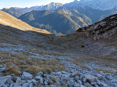
There has been no rain since 3pm. We decided to have a late lunch and explore the saddle. Few of us stayed at the camp. We could not find any path leading to the saddle, just finding our own trail. The last few hundred meters are more challenging, the slope is around 32 degrees. It was wet, snow patches sometimes, full of small rocks. For me, it was better to go left and then return to the right side. We had poor visibility at the saddle so could not explore what the ridge looks like or the way down. We returned by dark to the camp. It started raining again during the night.
We were able to get some weak signals here, so we fetched the weather forecast. It was looking better in the next 2 days.
Day 4-5: Stuck below Lasil pass - Sep 21
Day 6 - Lasil pass to Latpari pass (2 different ways)
We decided to split into two groups. One will go down and the other one will continue.
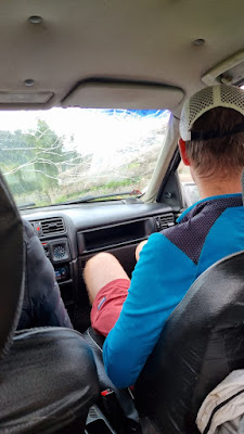
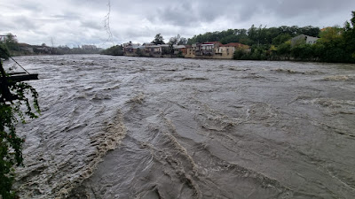
Our group went down the valley in the morning. The river got more wild but we still were able to jump via stones. The weather was still awful. Foggy and rainy everywhere around us. As we were approaching the Zigandi village there were 2 young boys riding horses. As they saw us, they called their father. He went to greet us and offer their accomodation. As we only needed a ride to Lakhori, we tried to bargain the price. He first said 150 Lori, too much for a 10 km ride. We were able to reduce it to 80, but it still could get lower.
We got into their car. It was an old Opel with a cracked windshield and non functional drivers panel. The road was muddy at first. It later became a concrete panel road. Sometimes just one line, some road work blocking both directions.
The first guest house we tried was closed due to covid. The second house was opened and they had free rooms. We agreed quickly as we wanted food. Later the wake up call. First, they did not have any wifi (data usage problem?) but the most we needed was a furnace with fire - to quickly dry their shoes. They said they don’t have one. We saw a chimney outside so after some arguments (we were going to leave), they agreed. There were no guests, just us.
The young lady was speaking fluent English so we were able to negotiate and agree on everything. After all, it was fine to stay over.
Day 6: Lasil pass to Latpari pass - Sep 21
Day 7 - Latpari pass
The agreement was to start early in the morning. Although they usually serve breakfast at 8, they made it earlier by half an hour. The ascent to Latpari pass was quite quick, as we followed the gravel road. The pass was ours by early afternoon. We finally made contact with our friends. The meeting point was set to be Mishura peak. 3120m peak east from the pass. It is an easy hike up. There are a couple of options we chose for the ascent from the north.
We met our friends after 2 days of no contact. They were exhausted and we all wanted to get down to Usghuli the same day, So after a short break, we continued hiking towards Usghuli.
The last break was at Gvinari. We saw another hiker coming from the Ushguli to take pictures. He was accompanied by a dog, of course the dog came to us and he spent the rest of the day. The descent was long as we were already tired and slowly it was getting dark. We arrived down to the valley when it was already dark. It is now the time to find an accomodation. We tried first the village across the river, Murkmeli. No luck finding something, one local just sent us to Usghuli. We continue on the road and try to use google to find accomodation. We found a few tips and as we are approaching the Ushguli village, we see some buildings that could be guesthouses. We turn right to cross the river (the bridge itself is an adventure. Being dark, it was quite a crossing as there were a lot of holes). We found 2 accomodation after all, and chose the first one as we were already in. They offered us dinner (it was already late for dinner).
Day 7: Latpari pass - Sep 21
Day 8 - Crossing Khlade valley via Karetta pass
We were initially thinking about taking a day off. But due to the weather forecast, we decided to just rest in the morning and continue hiking in the afternoon. The plan was to sleep close to Bezengi wall and continue to Mestia the next day (2 quite long days ahead with promising weather).
We wanted to buy bread and some cakes. There was almost no shop, we stopped by at one bar on the way. Bought the bread, beers and continued to the mountains again.
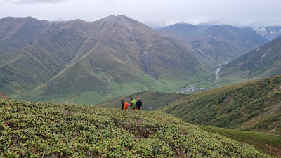
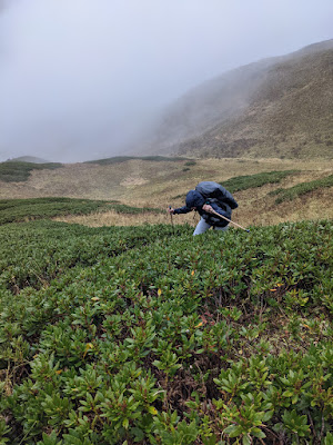
The descent from Karetta pass looks tricky from above. There are steep parts but we went more to the right and were traversing with descending. After all, it was fine to descend. What was waiting for us later was the difficult part. Again Rhododendron fields everywhere. We gave up with going somehow all around it and were just fighting with them. After a couple of minutes, we found some old tracks. We just followed them. They helped us to get out of this field and down to the Khalde valley.
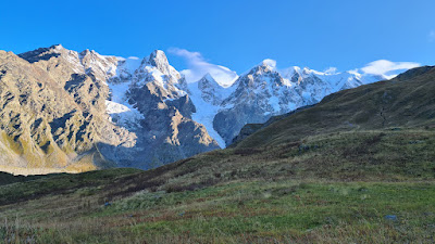
The Bezengi wall is impressive. We saw it a few days back from a distance. But having this wall in front of you just a few hundred meters is something else! We were looking for a camping spot closer to the wall when the sun was behind the horizon. We quickly built our tents, prepared dinner and watched the wall.
Day 8: Crossing Khlade valley via Karetta pass - Sep 21
Day 9 - From Zaresho-Khalde glacier to Zhabeshi
Another long day ahead. We have to cross the glacier (nothing fancy, just need to be careful and watch where you step). It is quite thick still, we were quite surprised once 2 of us went down to see it.
We continued further as we had to climb Chkhunderi pass via the ridge.
The taxi waited for us at Zhabeshi (the lady from the hotel helped us to book one). We arrived down the village very late again. We returned to Mestia, to the same hotel as we were accommodated previously. The shashlik is so delicious and practically it is everything here!
Day 9: From Zaresho-Khalde glacier to Zhabeshi - Sep 21
Mestia & Kutaisi: 2 resting days
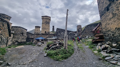
The morning started at the Svaneti museum. We found a small cinema on the way to the museum (DEDE movie movie is played there every day): Pub & Cinema DEDE. Worth visiting and watching the movie! We also experienced a power cut. Mestia village was affected. We were in the bar at that time, we could not later withdraw money or get coffee. It lasted about 3-4 hours.
We visited the Svaneti museum and one Svaneti tower at the end of the Mestia.
After one rest day in Mestia, we were going back to Kutaisi. There was a rockfall on the road. One truck had to stop and check if they could come through.
On the way back, we wanted to see and possibly swim in the Black sea (Anaklia Beach). It was completely ghosted. As there were big waves, only a couple of Baywatch were there. They warned us not to swim due to waves and strong currents.
We were given a very good recommendation for the restaurant near Zugdidi: Restaurant “Kingdom of Kolkheti”.
We wanted to do wine tasting, visit some museums and the city center. But we found out there is a cave outside of the city (Metheus cave). The trip to the cave was interesting via the local transport. Also on the way back, we stopped in the village for the great wine tasting (Mate’s Wine Cellar). The experience was splendid! We learned how they make wine, chacha. We bought a lot of presents.
We flew in the early morning (the road to the Kutaisi airport is another experience, it is not that far but the road itself is just a dirty road without asphalt).
We had a great time together in Georgia and we happily came back. Thank you for all who we met there, we want to thank them for their hospitality.
Some tips:
Russian language is handy in remote places. Not a problem in Mestia
Withdraw money when you can. We experienced power cuts for a couple of hours. As a result, everything was closed (some had generators but did not have systems running). Or another problem you might face - some ATMs had limits like 500 Gel
gas cylinders can be bought in Mestia in a couple of shops
we did not find hiking equipment shops in Mestia (a lot of second hand shops or fake shops with regular clothing). Some shops were just closed (or rentals)
worth buying the local sim card. There is one shop in Mestia selling sim cards, or just buy at Kutaisi airport. The cellular coverage is quite good even in mountains (not that remote though). So you can get a weather forecast at least from time to time
people in remote villages will come to you and invite you to their homes - negotiate first before you go, and avoid surprises. Most people are nice but there are people who ask for unreasonable prices or you might not get what you need (our story with the furnace)
food shops are marked on mapy.cz. As we tried a few in different places, they might be closed or limited supply (you can always buy bread, coke or beer, but the rest is questionable). Mestia has few supermarkets where you can buy a lot of things
trails might exist on the map but due to landslides, they might not exist anymore. We lost trails couple of times, and finding a new way is experience on it’s own (slippery steep terrain or streams to jump over/cross)
Day 10-11: Mestia & Kutaisi resting days - Sep 21
Tour info
Start
Mestia
Stop
Zhabeshi (taxi back to Mestia)
Duration
8 days
Activity view
Day 1 - easy hikes
Day 2
Day 3
Day 4
Day 6
Day 7
Day 8
Day 9
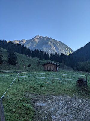
]]>Alpine Duocontact[at]alpineduo.comLechtal Alps: Around Namlos Wetterspitze hike - Sept 212021-09-04T00:00:00+02:002021-09-04T00:00:00+02:00https://alpineduo.com/hike/2021/09/04/namlos-wetterspitze-weekend-hike-21We started from Namlos village, there are free parking spots along the road.
The initial road leads to the Fallerschein dorf. We continued ascending along the river. The trail follows the river, so we had to cross it just once. It was not that wide so it was easy to jump over.
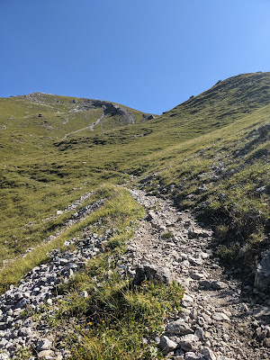
The trail goes to the saddle below Namlos Wetterspitze. This is when the real climb starts - 500 meters to ascend. Namlos Wetterspitze is 2553m high. I thought it would take too long to reach the summit. There is a cross at the top and also the summit book.
We descended towards the Anhalter hohenweg. From the distance the trail looks challenging but it is actually wide enough. No scrambling. This is one of the nicest spots of the day. It is worth looking back from time to time. Once the ridge ended, we had to descend down to the trail going to the hut.
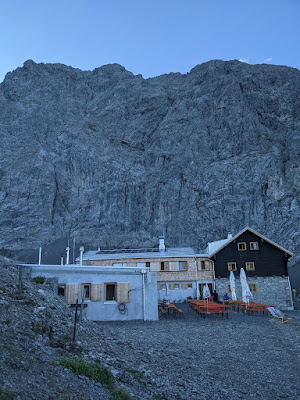
It took us 40 minutes or so to reach the hut. It was renovated recently (opened for sleep-overs 2 weeks ago only). The rooms are completely new. The location is very good, the views towards many peaks is something to remember.
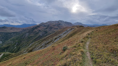
The second day was another sunny day. We saw plenty of people going to Namlos Wetterspitze peak but our destination was in a different direction. We first ended up at a quite short ridge (Faselfeiljöchel) where we turned right down to the valley. We follow Faselfeilbach river. There was a bridge where we wanted to cross but it was wiped away. We just jumped via stones. Once we got to the other side, we started ascending through the forest. The trail is split into several smaller ones created by cows or water. There is a nice creek with steps along the way. We were surprised to see it here as this trail is not marked. Once we left the forest, we saw a cabin. Perfect spot! There was no one or cows. The trail continues above the hut to Rudigerkopf. It is quite wide as it seems someone maintains it for cows. We reached the top of Rudigerkopf within a half hour. The best part of the day starts. The ridge is wide, nothing scary. We were following the trail and enjoying the scenery. The ridge ends at the Schlierejoch saddle. We had to join another ridge, leading to Engelspitze. The last summit of the day and what waits ahead is just Namlos village. The descent was boring (compared to what we hiked during this weekend) and slippery.
Lechtal Alps: Around Namlos Wetterspitze - Sep 21
Tour info
Drive
2:00 hours
Start
Parking lot right after Hängebrücke Namlos. There are 3 small parking lots along the road, free
Duration
12 hours (total)
Activity view
Day 1
Day 2
]]>Alpine Duocontact[at]alpineduo.comChiemgau: Kampenwand trails mtb - July 212021-07-21T00:00:00+02:002021-07-21T00:00:00+02:00https://alpineduo.com/mtb/2021/07/21/kampenwand-trails-mtb-21I realized while looking at Kampenwand map area we never reached Steinlingalm by bike. The last time we bailed out earlier at Gorialm.
The parking lot was almost full, possibly due to warm weather without any rain. It’s been raining almost daily in the last weeks. Hey, summer where are you? :-)
The beginning is harder, there is about 1 kilometer of rocky section that possibly became more rough after these rains but it might be just me not remembering it well. It’s easy to navigate, just following bike signs. We passed by Gorialm where most of the people ended their climb (it was full of people even when we were going back and it was close to sunset).
The most challenging part became after Gorialm where we started overtaking bunch of cyclist and we decided to keep the pace higher. It tooks us 2:30 hours to reach Steinlingalm. We were alone with just 2 more bikers. The Alm was closed already as we arrived late but they provide fridge outside where you can find drinks and you can leave money, nice!
We continued to Panorama weg, to gain about 30 ascent meters. This is usually crowded but not at this hour during the week. We were alone enjoying the views (the teaser picture is the one we took from there).
We descended via normal access road that is damaged due to heavy machinery have been using it. Two parts are quite steep, loose gravel (rain helped as well), even walking was difficult for a bit, we were going along the road. So the fun trail starts at Gorialm.
The first short section is S2 trail to reach the meadow. Couple of turns and you are at the meadow. The trail here is S0, we would not repeat this part if we can the next time. Once we joined the Reitweg, we recognized where we were and we continued on well-know trails down to Aschau.
Kampenwand trails mtb - July 21
Tour info
Drive
55 minutes from Munich
Start
Naturbad Aschau, free
Duration
2:00 hours
Activity view
]]>Alpine Duocontact[at]alpineduo.comSchliersee: Huberspitz trails mtb - June 212021-07-04T00:00:00+02:002021-07-04T00:00:00+02:00https://alpineduo.com/mtb/2021/07/04/huberspitz-trails-mtb-21We had limited time the previous weekend, we were looking for shorter ride. Schliersee offers couple of shorther trails like Huberspitz trails.
You need to climb to Almbad Huberspitz first. We stopped for a minute and we continued further about 1 kilometer to get to the starting point for the busline trail. There’s bigger open area with a small wooden open structure (looks like a bus stop). The trail starts with smaller uphil section and then just goes down all the way to the Hausham. There are few difficult spots, mainly due to recent rains although as I read most of the days it is muddy. I would rate this as S2. Few branches or smaller trees were layed down crossing the trail. Someone intentionally place them there.
The second round starts by climbing again the same way up, this time we stop at Almbad Huberspitz. The hut was closed eventhough it was Sunday afternoon and it should be opened (no reason give, just it’s closed).
The second trail is easy way down via 682a path (rated as S1). We met locals at the trail beginning who told us this path will be closed for bikers soon. There were no signs at the moment but as we heard and later read online, it was decide to be for hikers only and the signs will come soon (June 2021).
Schliersee Huberspitz trails mtb - June 21
Tour info
Drive
45 minutes from Munich
Start
Alpengasthof Glück auf, free
Duration
2:00 hours
Activity view
]]>Alpine Duocontact[at]alpineduo.comKarwendel: Bayerkarspitze ridge hike - Nov 202020-11-14T00:00:00+01:002020-11-14T00:00:00+01:00https://alpineduo.com/hike/2020/11/14/bayerkarspitze-ridge-hike-20Time for another ridge hike! Our tour started at the parking lot near Oswaldhütte, Karwendel. Be warned about parking only in designed areas as this is nature park. We parked along the road first behind other cars but a ranger gave us a friendly warning while he was passing by.
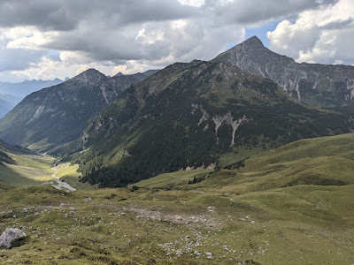
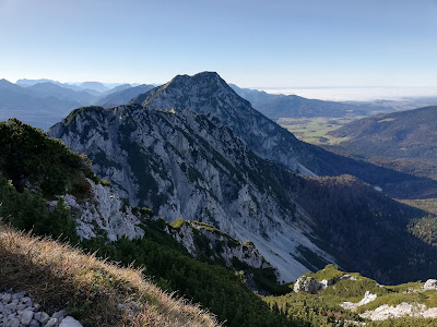
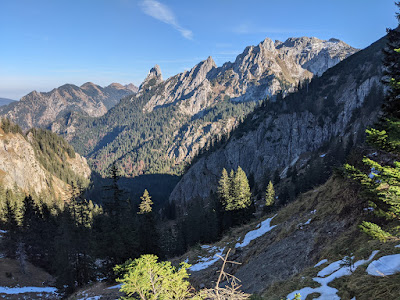
The first summit is about 2:30 hours away from the parking lot. From the first summit, the trail continues along the ridge and almost constantly up and down. The trail is easy to follow, wide most of the time (at least in the first half, once it becomes more rocky, it gets more narrow). We continued to Fermerskopf where you can see much further ahead. We finally spotted Krapfenkarspitze, our highest peak. First thought how to get to the top, will it go via that ridge or we go around?
The trail started to be more interesting as we were approaching Krapfenkarspitze. We initially lost a trail right below the summit so we had to scramble a bit through the rocks. The trail was actually going around these rocks. It took us 6 hours to reach the highest point of the day. The summit is quite spacious, we took a longer break to enjoy the Karwendel scenery and rest. We reached one more summit (Gumpenkarspitze).
We descended down to Jägersruh saddle. The way back goes below the summits we just reached. It is quite nice traverse through the woods. The trail looks unused much, destroyed sometimes or just abandoned. There are some challenging parts that were waiting for us. The trail just vanished due to rock fall or water made its marks. We jumped from one part to another or carefully stepped through narrow sandy residues. We got back to our car after almost 10 hours just before it got completely dark.
This was a beautiful ridge, worth doing in the opposite direction the next time with more peaks if we can.
Karwendel: Bayerkarspitze ridge hike - Nov 20
Tour info
Drive
1:20 hour
Start
Parking lot before or after Oswaldhütte, free. Note: do not park along the road if it is not designed parking lot, as it’s nature park. We were warned by a ranger after we parked just along the road.
Duration
7:45 hours
Activity view
]]>Alpine Duocontact[at]alpineduo.comChiemgau Alps: Staufen ridge hike - Nov 202020-11-07T00:00:00+01:002020-11-07T00:00:00+01:00https://alpineduo.com/hike/2020/11/07/staufen-ridge-hike-20The Zwiesel-Hochstaufen ridge is visible when driving from Salzburg to Munich from the highway. It is imposant long ridge through a couple of peaks. I wanted to sleep over at the Reichenhaller Haus this year but due to the restriction it is not possible currently. We decided to complete the hike just in one day.
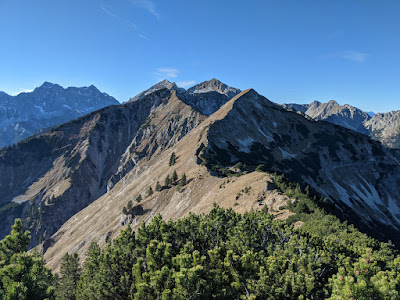
Our day started at 7 am at Adlgaß parking lot. It was almost empty at this time. The hike starts with traversing below Gamsknogel to reach Kohleralm. Berchtesgadener Alps are in front of us. However, all the valleys around are covered by fog. What a contrast! We continued from Kohleralm to Gamsknogel and we reached its peak shortly after, 2 hours from our hike start. While we are having a break, we are looking ahead at the ridge and guessing where the hiking trail leads.
From this moment, we are on the ridge trail through multiple peaks. There are very few fixed ropes. The second main peak of the day is Zwiesel. Hochstaufen is visible from here in its beauty. The next in line is Zennonkopf, reachable within a couple of minutes. From Zennonkopf, there are good views back to the ridge we already did and the one that follows to Hochstaufen. Roßkarscharte is an interesting section as there is a scrambling part with some fixed ropes.
We took a short break at Mittelstaufen. There are paragliders with us here, they are waiting for good conditions here as well. There are much more hikers as the trail from Bad Reichentall connects right below Mittelstaufen. Our steps continued to Hochstaufen, we were greeting too many people. There were about 30 hikers at the top of Hochstaufen resting. Resting at the top did not make much sense so we rather descended dozens of meters down to avoid the crowds.
The descent back to Adlgaß goes through rocky terrain, we were losing meters very quickly. Once we reached the forest, the trail became wider and it was just about to return back to the parking lot. We managed to return while there was still light. The parking lot was completely full compared to the morning when we started.
Chiemgau Alps: Staufen ridge hike - Nov 20
Tour info
Drive
1:20 hour
Start
Parking lot at Adlgaß, free
Duration
7:15 hours
Activity view
]]>Alpine Duocontact[at]alpineduo.comAllgäu: Tegelberg - Säuling 2 days hike - Oct 202020-11-01T00:00:00+01:002020-11-01T00:00:00+01:00https://alpineduo.com/hike/2020/11/01/tegelberg-weekend-hike-20We did not spend many night at the huts this year, the last time I was in Ester mountains for a weekend. Therefore we started looking if something was available, a hut somewhere where we have not been yet. We found Fritz-Putz Hütte, it has online booking system so we could easily find some available places. The location is perfect, in Allgäu mountains. We visited the area once to see one of the most famous castles, Neuschwanstein. Athough it turned out that the castle was not our cup of tea (a story for another day).
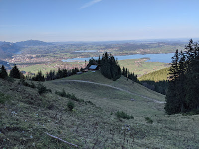
We started early on Saturday. The hike starts at Tegelberg lift station. Note, the parking there is time limited as you are not supposed to park overnight (22h-6h). We started ascending via the trail that is also for skitouring. It goes through Rohrkopfhütte and Tegelberghaus. We had a short break at Tegelberghaus. The sun was shining and we were enjoying a very warm day at the end of October.
From Tegelberghaus, we continued to Branderschrofen. This is just a small detour worth taking, with small scrambling to the peak’s top. We continued towards the hut. We reached one more peak along the way, Ahornspitze. The views are pretty spectacular and before we knew it, we were planning future trips. From Ahornspitze, we started descending to Bleckenaustraße, which leads to the Fritz-Putz Hut. The hut was renovated and it provides everything a hiker needs.
Second day we continued to Säuling, Danka decided to have a rest day. The trial to Säuling starts directly from the hut and traverses to the peak. Somehow we managed to get pg the trial but then found our way back, by ascending 50 vertical meters. We scrambled through the dry stream back to the trail. A rocky section starts by the end of the traverse. There are fixed ropes and one or two ladders, nothing exposed or difficult. There was only one fellow hiker that we have encountered along the hike.
The descended lead to Säulinghaus (again fixed ropes, plenty of rocks) which was unfortunately closed so we continued towards Neuschwanstein. From the Säulinghaus, it’s just easy hike back to the car, basically a descent through the forest back to the castle and then down to the village.
Allgäu: Tegelberg - Säuling weekend hike - Oct 20
Tour info
Drive
1:25 hour
Start
Parking lot at Tegelberg, paid. No overnight parking allowed, you better to park it somewhere nearby
Duration
11 hours (total)
Activity view
Day 1
Day 2
]]>Alpine Duocontact[at]alpineduo.comGarmisch: Alpspitze hike - Sept 202020-09-11T00:00:00+02:002020-09-11T00:00:00+02:00https://alpineduo.com/hike/2020/09/11/alpspitze-hike-20Let’s return back to September. We took the day off on Friday, to avoid crowds in Garmisch and to enjoy finally some warmer days. Our start of the day was very early as we arrived to Grainau at 6 am. The main reason was the hike takes the entire day (activity time is 10 hours). The first steps were towards the Kreuzneckbahn station. We passed by the station and continued towards another lift station: Alpspitzbahn lift station. We saw the first people arriving from the valley. From the station there is a hiking path leading to the Alpspitze south ferrata, just 15 minutes away. We took a short break where the north facing ferrata starts There were lot of climbers training here.
The ferrata through the south face of Alpspitze is rated B/C. There were already people ahead of us, we had to wait from time to time. As we were approaching the summit, the fog took over the summit. We reached the top, took a summit photo and continued towards Grießscharte. We were afraid the weather could change later in the afternoon (at least that is what the forecast said).
This ridge walk is less crowded, we only met few hikers (if you compare it to Alpspitze trails). It is well marked, but you can just follow the trail without problems. This was the best part of the day. Just us enjoying the sun that appeared out of clouds and the views towards Zugspitze. The entire Jubileumgrat is in front of us. This can be one of the goals for the next season.
We descended via Mathaisenkar. It is another B/C ferrata trail, leading to Höllental valley. It’s well secured, only few spots are airy. We were looking forward to the Höllentalanger hut to rest. There were lot of tourists coming from Garmisch via Höllentalklamm.
We continued via Höllentalklamm back to Garmisch. There is an entrace fee (we noticed the sign later on the way down). Höllentalklamm is another highlight of the day. We arrived back to our car 10 hours later. We were exhausted but full of excitment that we finally went up to Alpspitze.